Friday
03.2026
Discover Ha Giang Loop Map: Vietnam’s Scenic Adventure Awaits
30 Jul - 2025
The Ha Giang Loop Map is an essential guide for travelers looking to explore one of Vietnam’s most scenic and adventurous routes. Located in the northern mountains, the Ha Giang Loop stretches across winding passes, majestic valleys, and traditional ethnic villages. With its complex road system, having a reliable Ha Giang loop route map helps you navigate through major stops and hidden gems with confidence. In this article, Mr. Biu will help you to take a closer look at the full Vietnam Ha Giang loop map and essential travel tips to make your journey unforgettable.
Tucked away in Vietnam’s remote northern mountains, the Ha Giang Loop is a legendary motorbike route that winds through rugged limestone peaks, misty valleys, and ethnic minority villages untouched by mass tourism. Adventurers from all over the world are drawn to this wild frontier, not only for its dramatic landscapes but also for the cultural richness that each twist and turn unveils.
But this journey isn’t a simple one. With endless mountain passes, confusing forks in the road, and limited signage in rural areas, navigating without a Vietnam Ha Giang Loop Map can be both frustrating and risky. In fact, a reliable Ha Giang loop tour map isn’t just helpful, it’s crucial.
In the heart of this complex network of mountain roads, a physical or digital map of the Ha Giang loop becomes your most trusted tool. Here’s why:
Discover more: Top Things Not To Do In Ha Giang Loop
Navigating the Ha Giang Loop map is like unfolding a treasure trove of Vietnam’s most dramatic landscapes. Each route offers a unique blend of natural wonders, cultural encounters, and adrenaline-pumping rides. Here are four must-experience stretches that will make your journey unforgettable:
Find out more: Best Trekking Trails in Ha Giang: Top 6 Trekking Routes for 2025
The ride from Ha Giang city to Tam Son is ideal for beginners or short tours, stretching over a highland path about 1,000 meters above sea level. Despite its relatively short distance, it is one of the most scenic roads on the Ha Giang motorbike loop map. Imagine gliding through the cool mountain air while being surrounded by layers of terraced rice fields, dense forests, and peaceful villages in Ha Giang.
From October to December, the region blooms with delicate buckwheat flowers, coloring the landscape in pastel shades. This is also Ha Giang festival season, when local communities celebrate traditional events like the Gau Tao and Cau Mua festivals. Markets like Cho Phien and Quyet Tien add even more cultural flavor, offering a lively exchange of handmade crafts and mountain specialties.
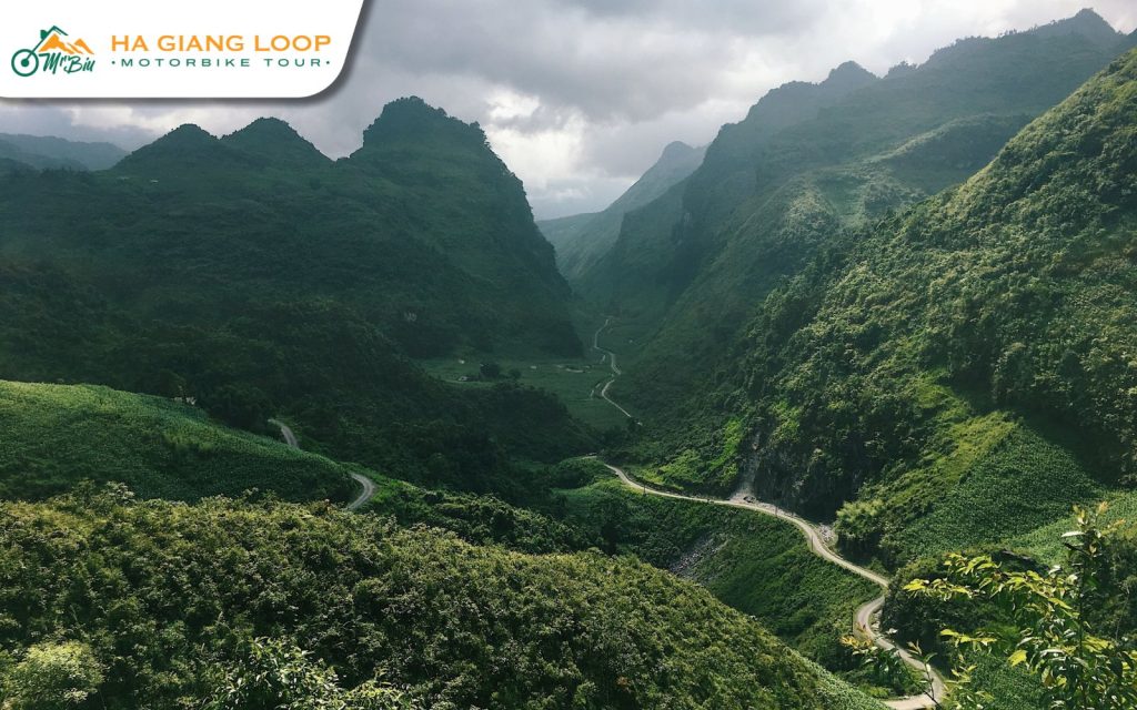
This stretch of the Vietnam Ha Giang loop map invites you into an ever-changing landscape, from sharp mountain ridges to whispering pine forests. October to December remains the most magical period to travel here, with hillsides blanketed in blooming buckwheat, adding a poetic touch to your motorbike adventure.
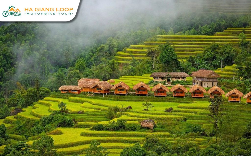
The Yen Minh Pine Forest, often compared to Da Lat’s cool retreat, is a top highlight. Riding through its cloud-covered mountain passes in Ha Giang offers a peaceful yet dramatic contrast to Vietnam’s tropical heat. Nearby, Du Gia village tempts travelers with its slow pace, ethereal waterfalls, and traditional Tay houses nestled among clouds and green valleys.
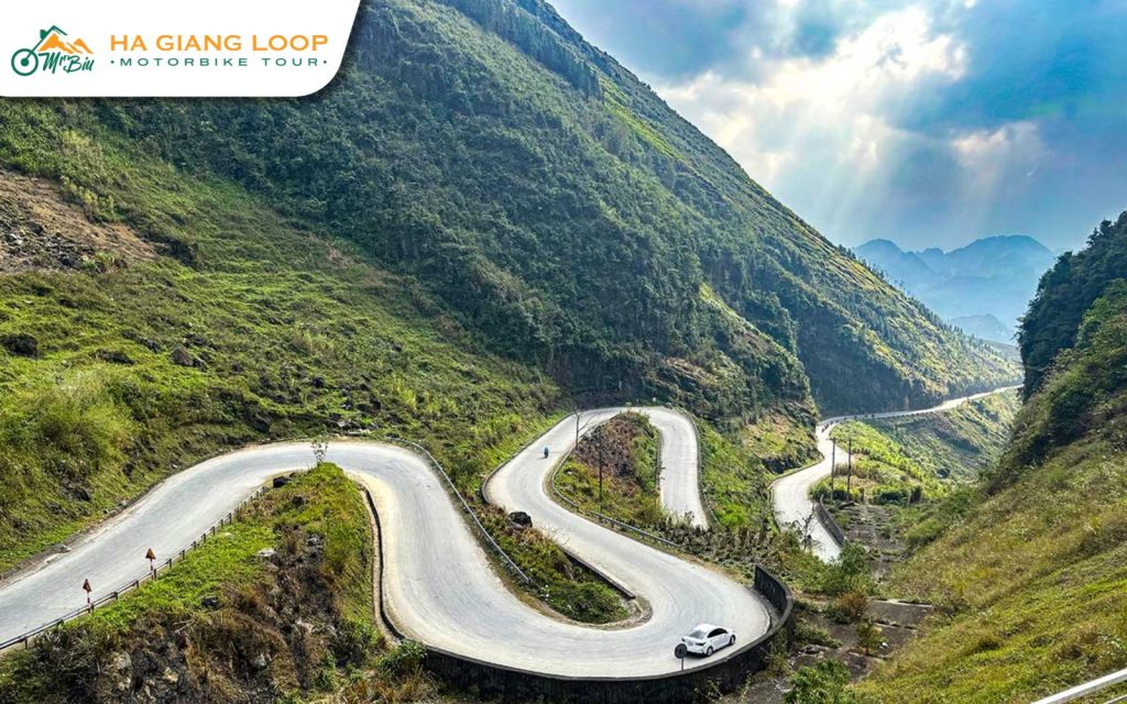
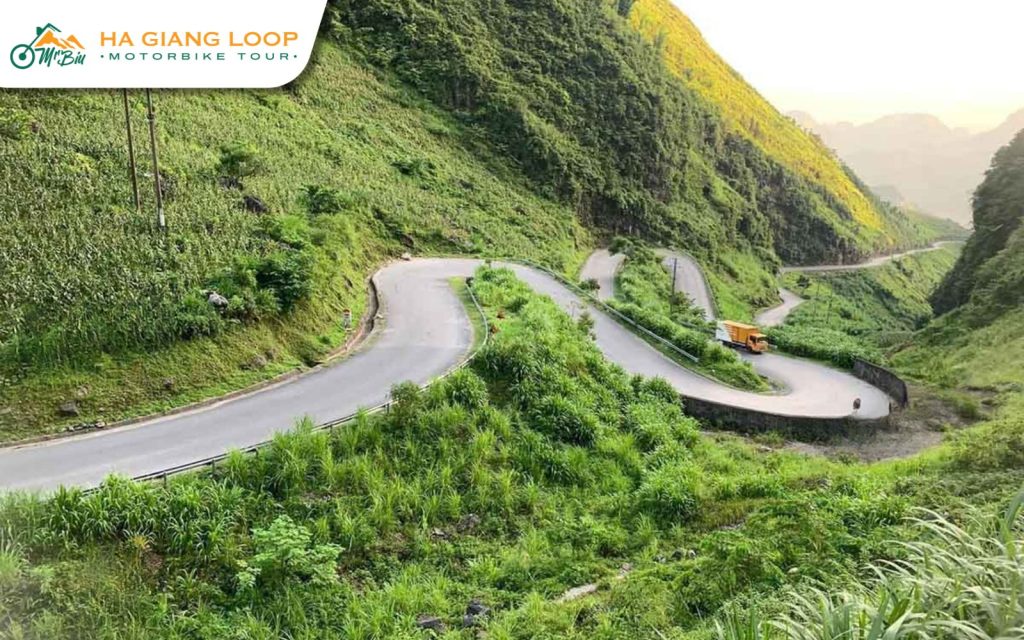
Marked on every serious Ha Giang loop route map, this is the leg that calls to the thrill-seekers. The roads here twist and climb through cliffs and steep passes, offering a ride that’s equal parts danger and beauty. It’s the essence of what makes the Ha Giang loop Vietnam map such a prized route among motorbike enthusiasts.
Dong Van itself is a historical marvel – An ancient town cradled by stone plateaus and colonial-era architecture. A blend of rocky wilderness and cultural richness, this area showcases the unique lifestyle of ethnic groups like the Hmong, still living much as they have for generations.
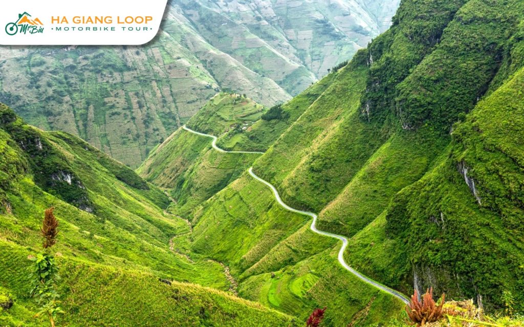
This final segment on the map of Ha Giang loop combines dramatic passes with moments of calm reflection. Your ride begins with the legendary Ma Pi Leng Pass, often hailed as one of Vietnam’s most jaw-dropping roads. As you weave along its serpentine route, the Nho Que River shimmers below, and rice terraces cascade down like golden steps. Once in Meo Vac, the cultural depth continues. Local hill tribes, vibrant markets, and the stark, untouched landscape offer a glimpse into a Vietnam few tourists ever see.
From there, the road to Du Gia is quieter but no less impressive. A bit challenging at times, especially along the Sung Trai path, but the rewards are many—crisp mountain air, lush valleys, and the turquoise waters of Tham Luong waterfall, a perfect place to end your Ha Giang loop on map journey.
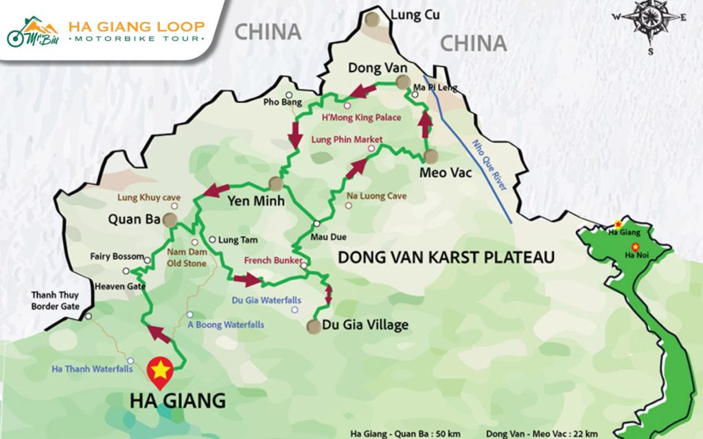
Each destination along the Ha Giang loop route map adds a unique flavor to your Northern Vietnam adventure. Let’s dive into the key stops you should include on your loop itinerary:
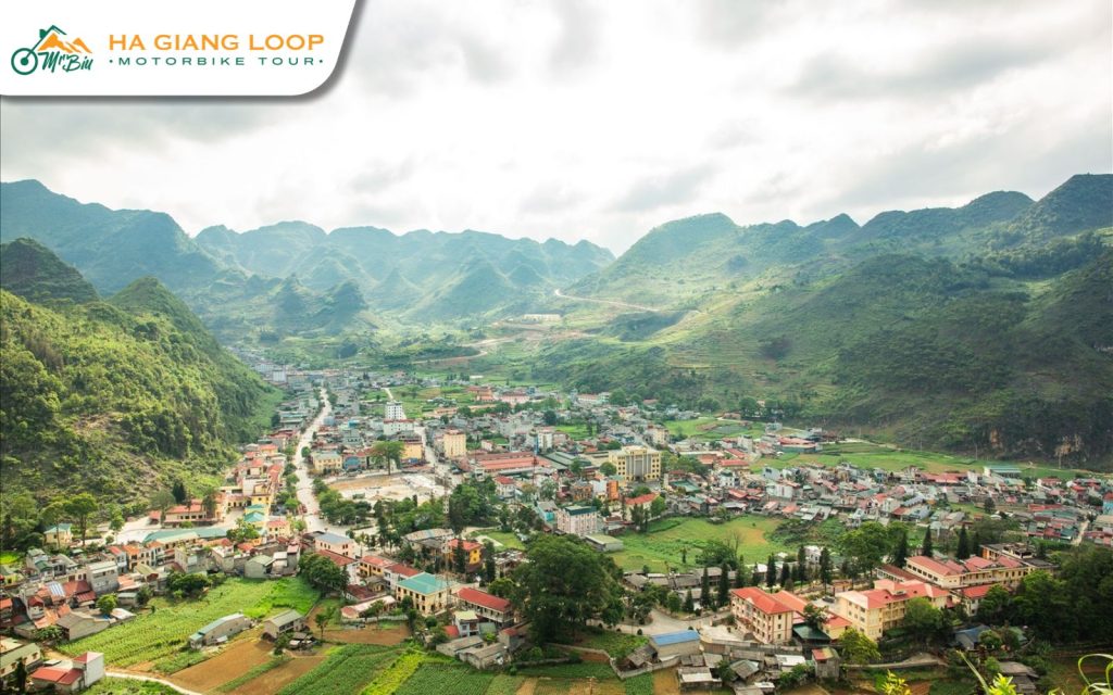
Ha Giang City is the ideal launching pad for any motorbike adventure along the Ha Giang map. This bustling town offers everything you need before hitting the road: rental shops, gear, supplies, and cozy cafes to relax in. Take some time to wander the streets, meet fellow travelers, and soak in the laid-back vibe before you begin your loop.
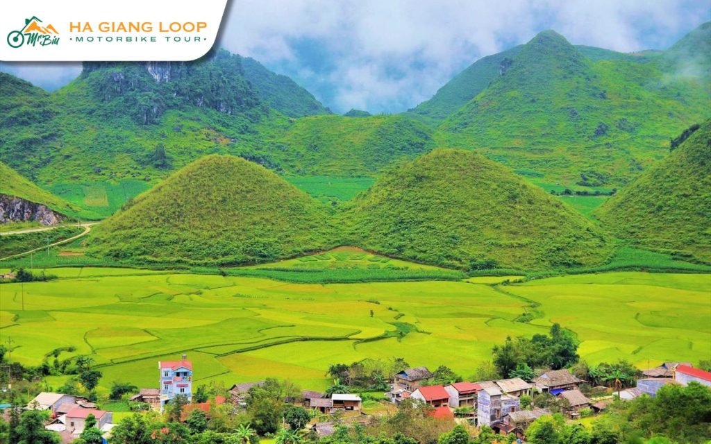
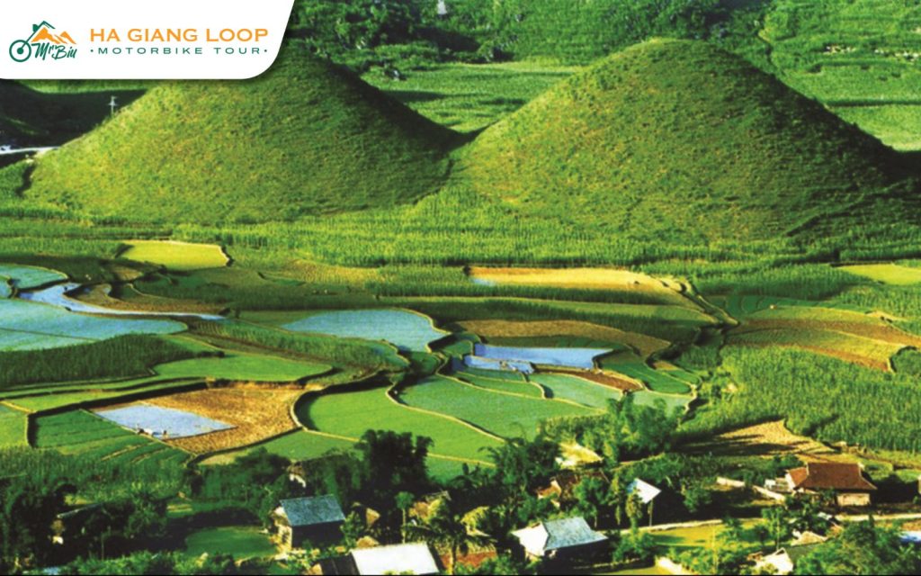
The first major stop on the Ha Giang loop tour map is Quan Ba, home to the famous Fairy Bosom Mountains. These two rounded hills are wrapped in local legend and natural wonder. Surrounded by terraced rice fields and misty valleys, the landscape feels like a dream. Quan Ba sets the tone for the surreal beauty you’ll continue to encounter throughout the loop.
Following the map of Ha Giang loop, you’ll arrive in Yen Minh, a peaceful town nestled among forests and limestone peaks. It’s the perfect place to refuel, enjoy a hot bowl of pho, and recharge. The road from Yen Minh to Dong Van is one of the most scenic on the Ha Giang route map, with sweeping valley views and photogenic mountain passes.
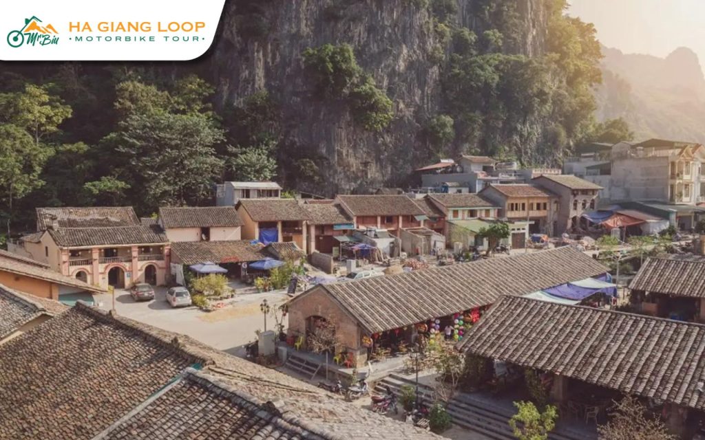
At the heart of the UNESCO-listed Dong Van Karst Plateau lies the historic town of Dong Van. Traditional clay houses, narrow stone streets, and a lively weekend market bring the town to life. This is a great place to immerse yourself in the highland culture while exploring one of the most iconic towns on the Ha Giang Vietnam map.
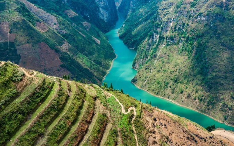
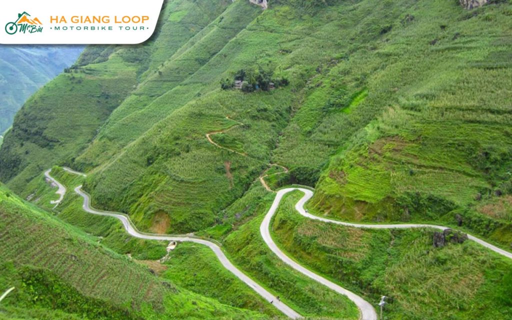
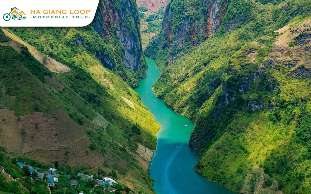
No route on the Vietnam Ha Giang loop map is as breathtaking as Ma Pi Leng Pass. Often dubbed the “King of Passes,” this 20-kilometer stretch will test your riding skills with its steep cliffs and tight turns. But the payoff is grand, panoramic views of the Nho Que River carving through Tu San Canyon, one of the deepest in Southeast Asia.
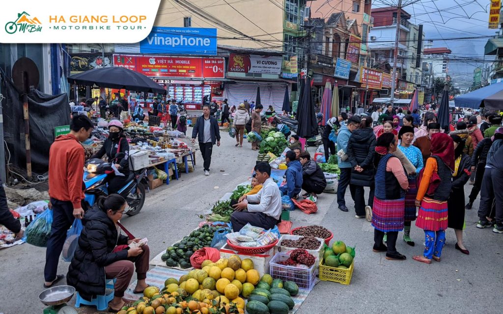
After the thrill of Ma Pi Leng, Meo Vac welcomes you with its calm and cultural richness. Surrounded by mountains, the town is a hub for ethnic groups like the H’mong and Dao. Wander through the local market to find vibrant traditional clothing and handmade crafts. Meo Vac is a peaceful stop along the Ha Giang loop on map and an excellent place to experience authentic highland life.
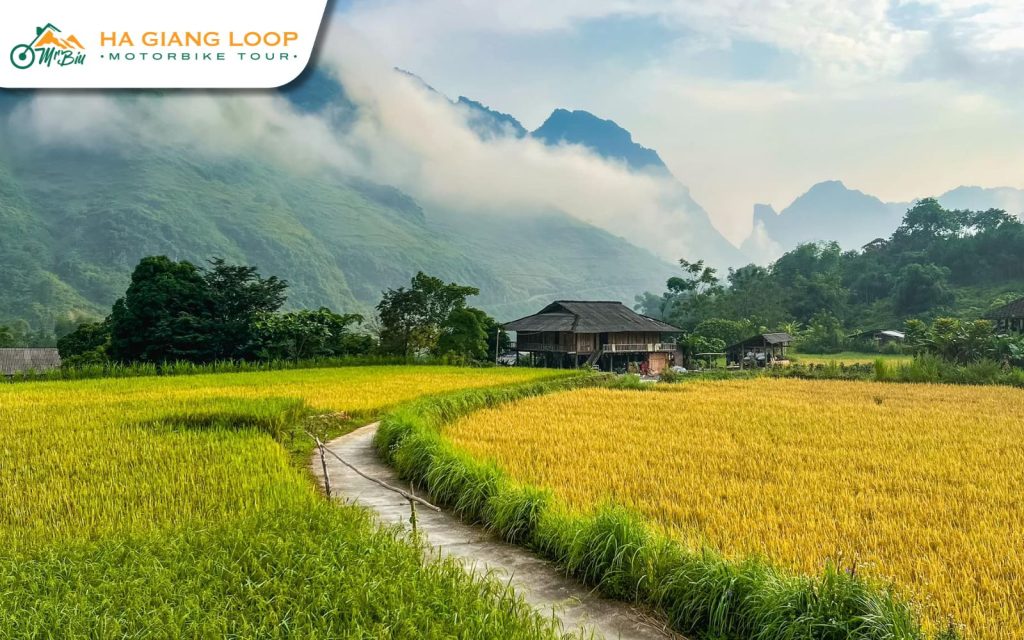
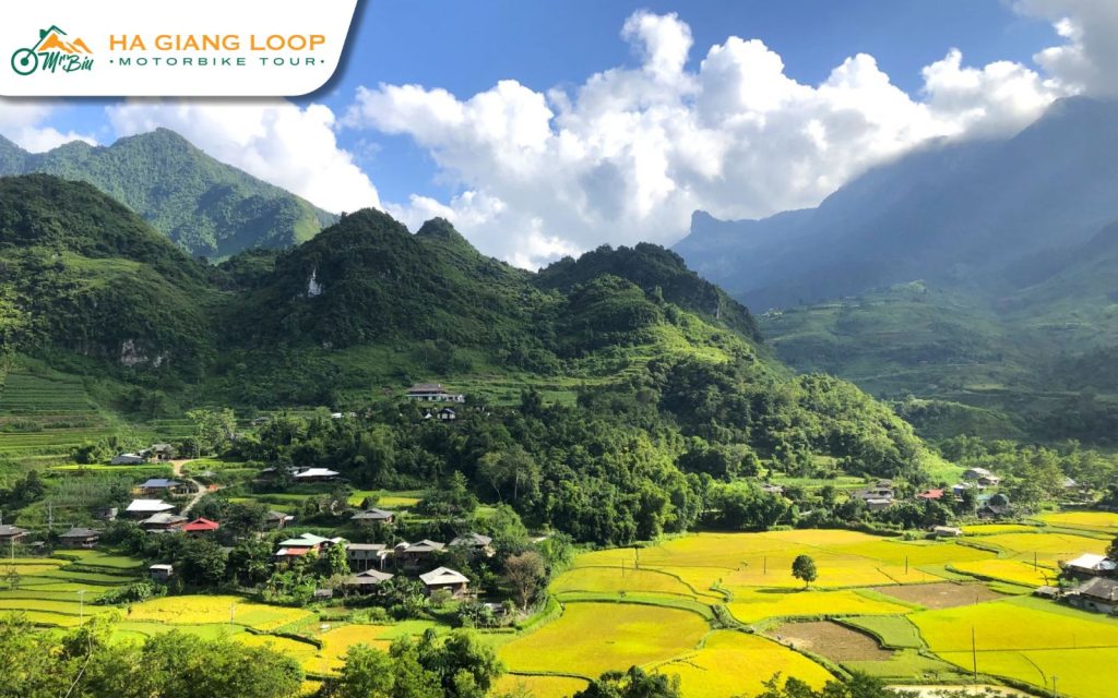
For a true off-the-beaten-path experience, venture to Du Gia. This small village, tucked in a green valley, is a paradise for nature lovers. Rice fields, and homestays, and waterfalls in Ha Giang Loop hosted by the Tay people make it a tranquil escape. Spending a night here offers a genuine glimpse into local life and a refreshing break from the road on the Ha Giang province map.
Beyond the winding roads themselves, your Ha Giang Loop Map pinpoints a collection of iconic landmarks and natural wonders that define the region’s breathtaking beauty and rich cultural tapestry. Let’s take a closer look at the key highlights that make this route truly iconic:
The adventure begins with a scene straight out of folklore – The Quan Ba Twin Mountains, affectionately known as the “Fairy Bosom.” Rising symmetrically from the lush valley floor, these two rounded hills are steeped in myth and surrounded by terraced rice paddies. According to local lore, they’re the eternal memory of a fairy’s love for a mortal man.
Stepping into the Dong Van Old Quarter feels like flipping through the pages of a living history book. Nestled along the Ha Giang loop on map, this ancient town showcases preserved clay-walled houses, narrow alleyways, and traditional wooden architecture that has stood for generations. Stroll the cobbled lanes or visit on Sunday to experience the vibrant ethnic market, a celebration of culture, color, and community.
Often hailed as the most dramatic section of the Ha Giang route map, Ma Pi Leng Pass is where the road carves through towering cliffs and offers jaw-dropping views of the Nho Que River far below. It’s a challenge for even seasoned riders, but the reward is pure majesty. Every bend reveals more of the vast canyon, making it the crown jewel of any ride along the Vietnam Ha Giang loop map.
Cutting through the steep walls of Tu San Canyon, the Nho Que River glows emerald under the sun. Best seen by boat, this tranquil river offers a peaceful contrast to the thrilling mountain roads. Floating through this natural corridor offers a front-row seat to one of the most photogenic corners on the map of Ha Giang loop.
Sitting at Vietnam’s northernmost tip, the Lung Cu Flag Tower is a powerful symbol of national pride. From its summit, you’ll take in sweeping views of terraced fields, distant villages, and the rugged border landscape. A short detour from the Ha Giang loop Vietnam map, this destination is a must for those seeking not just scenery, but a sense of patriotic spirit and geographical awe.

As you make your way through the Ha Giang route map, the Meo Vac Sunday Market is an unmissable stop. Locals from surrounding mountain communities gather here in traditional attire, creating a colorful, energetic atmosphere. It’s more than a marketplace, it’s a celebration of cultural identity, where crafts, customs, and cuisine converge. Bring your camera and your curiosity.
If you’re chasing thrills on the Ha Giang motorbike loop map, Tham Ma Pass won’t disappoint. Famous for its tight zigzags and steep climbs, this section challenges your reflexes while rewarding you with sweeping views of highland scenery. For riders, it’s a rite of passage, a place where confidence is built curve by curve.
To ensure a smooth and unforgettable journey along the breathtaking Ha Giang Loop, consulting your Ha Giang Loop Map is just the first step. Keep these essential tips in mind as you navigate this stunning region, making your adventure safer and more enjoyable:
Find out more: What to Pack For Ha Giang Loop: The Valuest Advises
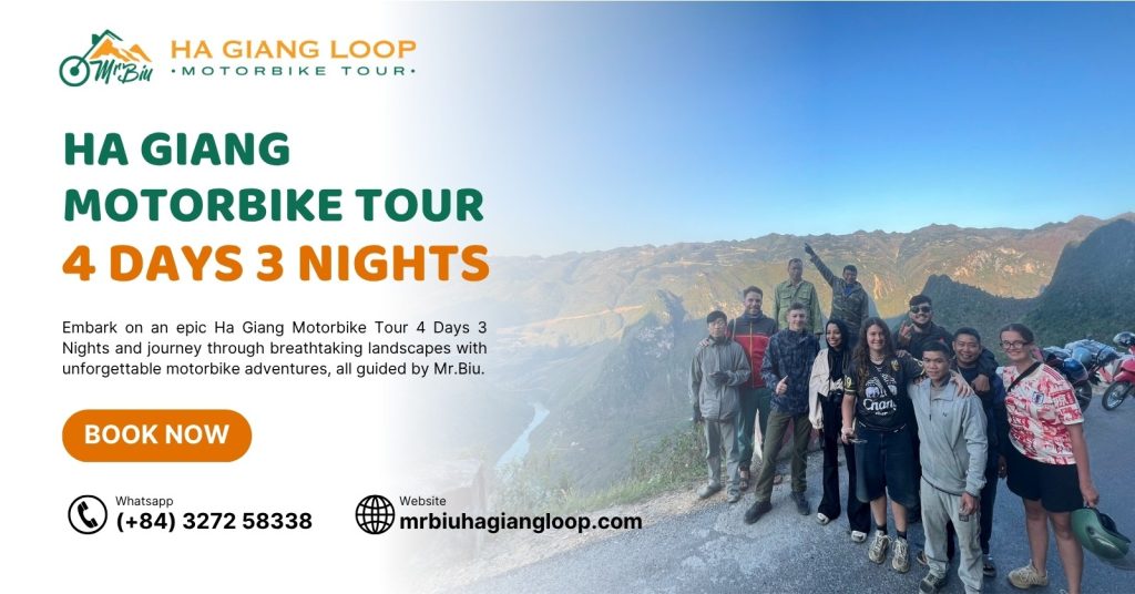
For travelers seeking a worry-free, deeply immersive experience, choosing a reputable and experienced tour operator is essential. Our Ha Giang motorbike and tour is widely trusted for delivering well-organized, all-inclusive motorbike tours. With local tour guides, thoughtful routes, and full support throughout the trip, Mr.Biu Tour is the perfect choice for those who want to ride the Ha Giang motorbike loop map safely while enjoying every moment.
Experience the Ha Giang Loop with ease and expertise! Our comprehensive tour package is designed to offer the best value for your Ha Giang Loop budget, including:
As a special perk, book Ha Giang Loop motorbike tour 4 days with us and enjoy a complimentary night’s stay in a dormitory bed at our hostel the evening before your tour kicks off, giving you a relaxed start to your Ha Giang Loop exploration.
See also: Ha Giang Loop How Many Days for the Best Experience
From misty mountain passes to vibrant ethnic markets, each stop on the Ha Giang loop map offers something unique and unforgettable. Each destination along the Ha Giang loop on map reveals a new layer of Vietnam’s identity, allowing travelers to connect deeply with the land and its people. Contact Mr.Biu Tour Ha Giang today to book your once-in-a-lifetime experience!